Hiking, trekking and lava tunnels in Reunion Island

Hikers, get your brogues out !
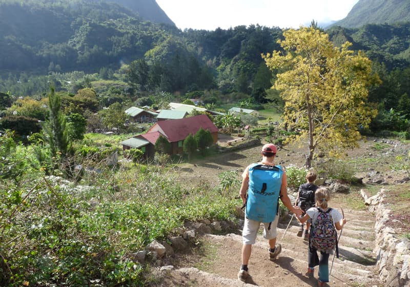
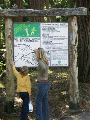
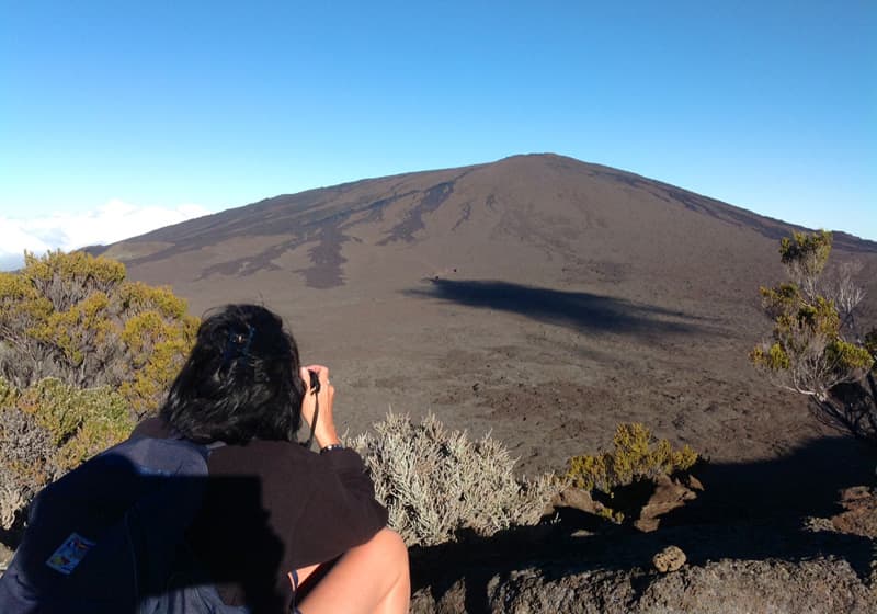
Reunion Island offers an exceptional playground for mountain lovers: a mountainous landscape (Piton des Neiges culminates at 3069 m altitude), authentic cirques free from civilization, a spectacular volcano, fascinating primary forests ... Everybody will find something to their taste and level: from the half-hour family walks (the famous "sentiers marmailles") to the "Grand Raid" which each year gets a few hundreds of runners rush through the island (8000 m difference in height!), everyone can find their way up! The National Forest Office has indeed marked more than 1,000 km of trails, not to mention the two big hiking trails ("GR1 and GR2") that crisscross the mountains of Reunion.
Volcanic caving, Lava tunnels
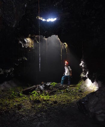
RICARIC invites you to take this opportunity to discover lava tunnels, Nature’s curiosities! Our state-certified speleology guides will share their passion for this underground environment unique in Reunion Island. For a half day hike or for a full day "exploration of the tunnels", visit the volcano’s backstage!
Since 1983, GILLES DUBESSET has felt the desire to share his experience and enthusiasm for this little corner of paradise unique in the world. Being State-certified, he offers a range of hikes and treks over one or more days. Depending on your wishes and your level, he offers personalized tours in addition to conventional hiking. Possibility of tailor-made Trail training programmes.
If you do not want to walk alone on the trails, you can hire a guide trained to help you discover the island in an original non-sporting and cultural way. A friendly formula for safe hiking and learning a bunch of anecdotes about local Nature and History, and sometimes a way to access not-so-famous places.
Lava tunnels
Thanks to its exceptional volcanic heritage, you will be able, accompanied by a qualified guide for maximum safety and explanations on volcanology, the formation of tunnels and the minerals that make up the lava, to explore the bowels of Piton de la Fournaise, in the south, or older tunnels in the west of the island.
From 6 years old, whether you are sporty or not, equipped with helmets and gloves, discover the geological treasures of one of the most active volcanoes in the world!


Trails
- For beginners
the Bélouve Forest, Trou de Fer ; La Nouvelle (Mafate) through le Col des Bœufs ; Marmites de Fleurs Jaunes in Cilaos ; le Pas de Bellecombe ; most coastal trails and "sentiers marmailles".
- For fans
Le Maïdo ; Mafate through the “Canalisation des Orangers”; the Volcano ; the ridge of “les Trois Salazes” in Cilaos ; Grand Bassin.
- For good hikers
Le Piton des Neiges, la Roche Ecrite, le Dimitile, hiking around “la Vallée Heureuse“.
Some advice :
* Clothing : Don't forget a fleece jacket (the temperature is bordering on 0 ° C in winter), a windproof raincoat or cape, and, of course, good light and studded walking shoes, a hat, sunscreen and a bottle of drinking water.
* Timing : Reunion Island is for those who get up early, and it is even more true for hiking! Indeed, mid-morning usually brings the fog, and early hours will allow you to enjoy the first rays of sun on the walls of the cirques.

* In your backpack : Make sure you take water bottles and a picnic for lunch, even if some "boutiques" in the "îlets"(the small isolated mountain hamlets) sell supplies during the week. If you have booked a gite or a guest room, you can also book your evening meal at their "table d'hôtes", a typical and convivial formula. Your hosts will provide sheets and blankets, so it is not necessary to bring your sleeping bag.
* Maps : IGN maps (official topographic maps) can be useful, or la Maison de la Montagne's guidebooks.
* Security : It is advised not to go out in the mountains alone. If you are really experienced and go out without supervision, take a loaded cell phone: even without a chip, you can join the international emergency phone number: 112. Your bag should also contain a headlamp in case you take longer than expected ...
Useful publications
-
152 randonnées à la Réunion (Austral Edition). Simple, clear and very well presented. There are maps, explanations, photos and useful informations.
- La Réunion - randonnées INEDITES,
Jean Paul Goursaud. Guide produced by the author of the randopitons.re website
- Sentiers Marmaille (46 promenades de 1 à 4 heures) Pierre Payet, Jean Marie Wallet. Editions ONF.)
- Itinéraires Réunionnais Jean Pierre Lorillot, Jean-Marie Wallet. Editions ONF.
- Les Plus Beaux Paysages de la Réunion en 80 Randonnées Luc Reynaud, Editions Orphie.
- Les Plus Belles Ballades à la Réunion.
Lucay Permalnaïck,Jean-Camille Didgen, Zalan Hoareau, Gilbert Deveaux, Gilles Elma
- 52 Balades et Randonnées Faciles à la Réunion. Luc Reynaud, Editions Orphie
- Guide Touristique Du Cirque De Mafate. Editions ONF.
- Topo Guides Sentiers Forestiers de l’Ile de la Réunion (25 randonnées). Editions FFRP.
Topo Guides des sentiers de randonnée (pour les grands marcheurs): GR R1 GR R2 et R3 / Le Tour du Piton des Neiges (GR R1 en 6 étapes)/ La Grande Traversée de l'île (GR R2 en 13 étapes) / Le Nouveau GRR3 (Tour de Mafate) Éditions FFRP (Octobre 2006)


